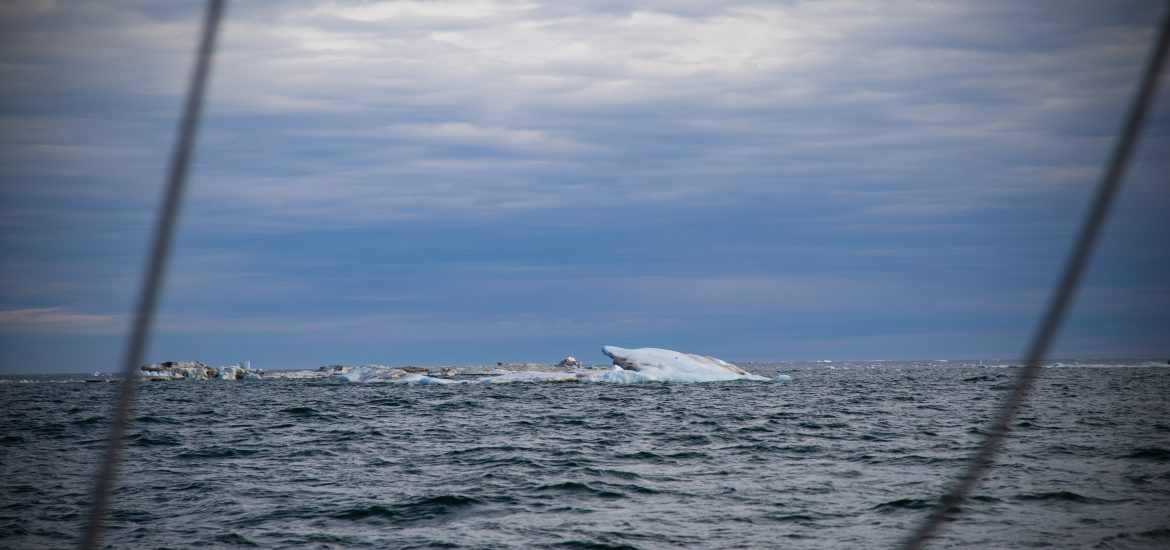
What makes the NW Passage so exciting/challenging/terrifying for any adventurer, is the unpredictability of it all. One day’s plan can be foiled by sudden changes in the forecasted wind, and depending on where you are in the water, can either be cause for alarm or a regrettable sigh of relief.
Historically, these uncharted waters have been notoriously difficult and dangerous to navigate. Ships have been lost trying to establish an alternate trading route from Europe to Asia. The first vessel to complete this was Gjøa, a 70′ boat with a crew of six, helmed by Roald Amundsen took three years to complete the journey in 1906. According to the Scott Polar Research Institute, since then, there have only been 392 maritime passages of the NW Passage. This includes commercial and private vessels. The early years included mostly only large vessels such as ice breakers and commercial ships. However, since the earlier 2000’s, thanks to climate change and the accessibility to navigation data, more and more private vessels have been daring to make the journey.

Since we’ve left Utqiagvik, the crew has been busy researching and developing various scenarios of routes we can possible consider. Our reading material has been cut out for us!
In addition to the books, one of our biggest tools is the live weather and satellite imaging we are using to get the latest and greatest of what lies ahead. The magic of Starlink makes being connected to not just our loved ones back home, but to the live research we need to make sure we keep our boat and crew safe, it helps making our best plans to make it through the passage be the most informed.
In addition to our regular wind forecasts and tide and current charts, here are a couple sources that we use to form a navigation plan:
Ice Charts
We’ve been using the Canadian Ice Service, which provides daily reports on current ice conditions.
Ice charts help us understand the ice coverage in tenths. 0/10s = ice free and 10/10 = solid ice
Now is the tricky part. There is a system called The Egg Code, which tells us more detailed information about the ice (stage of ice development and ice floe size). There are a maximum of three types of ice described within the egg.

Coding for Sea-Ice Stages of Development (So Sa Sb Sc Sd Se)
| Description | Thickness | Code |
| New ice | < 10 centimetres | 1 |
| Nilas, Ice rind | < 10 centimetres | 2 |
| Young Ice | 10 – 30 centimetres | 3 |
| Grey Ice | 10 – 15 centimetres | 4 |
| Grey-white ice | 15 – 30 centimetres | 5 |
| First-year ice | >= 30 centimetres | 6 |
| Thin first-year ice | 30 – 70 centimetres | 7 |
| First stage thin first-year | 30 – 50 centimetres | 8 |
| Second stage thin first-year | 50 – 70 centimetres | 9 |
| Medium first-year ice | 70 – 120 centimetres | 1· |
| Thick first-year ice | > 120 centimetres | 4· |
| Old ice | – | 7· |
| Second-year ice | – | 8· |
| Multi-year ice | – | 9· |
| Ice of land origin | – | |
| Undetermined or unknown | – | X· |
Coding for Forms of Ice (Fa Fb Fc Fd Fe)
| Description | >Width | Code |
| Pancake ice | – | 0 |
| Small ice cake, brash ice, agglomerated brash | < 2 metres | 1 |
| Ice cake | 2 – 20 metres | 2 |
| Small floe | 20 – 100 metres | 3 |
| Medium floe | 100 – 500 metres | 4 |
| Big floe | 500 – 2,000 metres | 5 |
| Vast floe | 2 – 10 kilometres | 6 |
| Giant floe | > 10 kilometres | 7 |
| Fast ice | – | 8 |
| Icebergs, growlers or floebergs | – | 9 |
| Undetermined, unknown or no form | – | X |
Lost already? Don’t worry, same here. Luckily Rusty broke it down for me in LAHMON’s terms (a pun on Rusty’s last name), but for those who really want to learn more on interpreting the chart, check out this Canadian government page on interpreting ice charts.
Here is an example of a chart of Queen Maude we were looking at yesterday.

Satellite Imaging
We’re also using this amazing free site called Polar View, which gathers real time satellite images from 17 countries satellites and combines them into an easy to view interface. We can sort the images and find locations that correspond with our ice chart. This allows us to see what the density looks like with real time imaging and these satellite images are INCREDIBLY detailed.
So if we were to compare the chart above to the latest satellite imaging, you would see this:

The orientation of the image takes a bit to get used to, but you’ll get used to it. Or maybe we’ve all been spending a little too much time upside down underway.
If you really want to nerd out on the SAR (Synthetic Aperture Radar) Satellites, check out this site here.
Since the satellites only orbit peridodically and they must conserve energy, the images don’t come in at a set point in time so we haven’t been able to depend on this as much. In addition, if it’s a cloudy day, we won’t be able to see the images as clearly.
So as you can see, it’s trickier than normal to form a navigation plan. As if weather was unpredictable enough, now factoring moving sea ice adds a whole other level complications and dangers.
Word of Mouth
There is also a great 2024 Northwest Passage Facebook group, and it’s been really fun to connect with other boats and get updates on their journeys. Everyone is sharing and trading real time information as it allows, and we hope we can see some other boats along the way. We already got to have a VHF chat with Seabelle, who was westbound as we crossed in the Chukchi Sea. They wintered over in Inuvik, Canada up the MacKenzie River, which is how they were able to finish their journey so early in the season.
Watching marine traffic, it’s fun to see all the vessels heading either direction start to convene in one place.
Victor the Predictor
Perhaps our greatest asset, are our ice forecast emails from Victor the Predictor. A retired Canadian Captain, who voluntarily has helped guide boats through the Northwest Passage for the last 15ish years. He sends out reports that incorporate charts, maps, ice charts, weather forecasts, tides, currents and wind reports. He’s familiar with the geographic landscape that doesn’t even appear in some charts.
Charts are notoriously unreliable in the passage. Most places that seem possible to consider for anchorage are questionable at best. Scouting and portable depth finders are essential for boats who wish to anchor in protected waters.
Victor’s list includes 24 vessels also attempting the passage this year, and when Graeme gets his emails, he reads them out loud for the crew for us all to compare with the information we’re tracking. That way we can decide if we have our crystal ball of ice calibrated correctly. For living in an fairly unpredictable world, Victor helps affirm any of our educated guesses.
As of today, we think we will be taking the following route:

If all goes well, we hope to be in Atlantic waters by the end of the month/early September. Who knows though, information changes daily, and there are so many factors that will go into this.
We just entered the Amundsen Gulf, and are heading towards Cambridge Bay. The wind has been great this morning and we’ve been rolling on between 7-8 knots. I’ve got homemade granola going in the oven, and everyone is starting to get a little loopy, but still in good spirits.
Thanks to everyone back home who are keeping our lives in order, and sending fair winds our way. So far it’s working, and we are so grateful!
thanks so much for the informtion on the egg charts glad the saiing is good today.
You’re welcome!
Appreciate the ice and route info. I’m excited for you to meet up with other boats doing the passage!
Hey, Dogbark!
Your adventures are turning our late-season, ultra-relaxed cruise in the San Juans into a real adventure. The Port Townsend Wooden Boat Festival – and preparing for it – left us exhilarated and exhausted. After a much-needed Internet purge at anchor off Stuart Island, Jack and I docked in the gentle comforts of Roche Harbor. At last, the chance to muse on the challenges of your expedition!
Having deliberately saved your emailed posts along with my stack of vacation books, I started here with your education on ice. Oh, my! Navigating through ice entails consideration of so many factors. It involves the whole crew – all brains on deck!
I was so torn not being able to attend the PT Wooden Boat Festival this year with the women in boatbuilding presentations. But alas, a trip of a lifetime! So wonderful you were able to catch up on our stories and have enjoyed the ice lesson!
[…] Passage. As they pass the Arctic circle, fewer than 400 boats have ever completed this trip. In “Through the Looking Ice,”I get an intro to the complexity of route planning through ice fields and the real-time tools now […]